Wednesday 26 September 2012

Vermont, New Hampshire and Maine

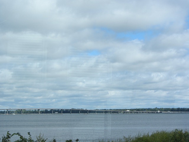
We crossed the border into Vermont at Rouses Pt driving onto Grand Isle on Lake Champlain, said to be the 6th largest lake in the US (after the 5 Great Lakes).
It has been so interesting travelling through the area of the St Lawrence Seaway especially to consider its history and the war of 1812, a military conflict fought between the US and the British Empire.
The US declared war for several reasons including trade restrictions, impressment of American merchant sailors into the Royal Navy, British support for the American Indian tribes against American expansion, outrage over insults to national honor after humiliations on the high seas!!! In light of recent events there is a certain irony!

But of course the history of the St Lawrence Seaway is so much more ... in providing a safe, efficient and reliable commercial waterborne connection between the Great Lakes region of North America and foreign markets worldwide. It annually supports 227,000 jobs, $33.6 billion in transportation-related business revenue, $14.1 billion in personal income and $4.6 billion in taxes. It annually saves shippers nearly $3.6 billion in transportation and handling charges that they would otherwise have incurred had they used other modes of transportation. Not to mention the St Lawrence-FDR Power Project which produces some of the continent's cleanest, least expensive electricity!! How's that for research!


Crossing into Vermont.


The Welcome Centre near Alburgh on Highway 2 was a wonderful spot to plan the next segment of our travels. Two ladies manned the centre.  They were enthusiastic and engaging; they even had a tour over our RV! They suggested our route to Maine through Vermont - on Highway 2 - and sent us down the Island, Grand Isle on Lake Champlain.  And how beautiful it was!


We have noticed a  black flag flying in certain places. I did a bit of research and found that it is a POW/MIA flag, an American flag designed as a symbol of citizen concern about United States military personnel taken as prisoners of war or listed as missing in action.
The POW/MIA flag was created by the National League Of Families and officially recognized by  Congress in conjunction with the Vietnam War POW/MIA issue "as a symbol of our Nation's concern and commitment to resolving as fully as possible the fates of Americans as prisoner, missing and unaccounted for in Southeast Asia, thus ending the uncertainty for their families and the Nation."

Highway 2 crosses  from one island to another on Lake Champlain; finally onto Grand Isle and then connects with I-89 to Burlington, the largest city in Vermont. Half of the population of Burlington is made up of students from the University of Vermont and the City's 4 colleges.

Trevor says - 'Lets go round the lakeside drive; the girls said that was a pretty drive.'  So we drive into downtown Burlington!!  Narrow streets, lots of people, tight corners, low bridges and power lines!!!  Not a good idea but a great opportunity to explore the beauty of its setting on Lake Champlain.  One hour later we manage to extricate ourselves from Burlington and back onto I-89 out of town to Waterbury/Stowe. An interesting drive.  I don't think we found the lakeside drive but we saw a lot of Burlington!

Our next stop was at Waterbury where within a radius of about a mile you could eat - and drink - to your heart's content, all local produce. Green Mountain Coffee, Cold Hollow Cider Mill, Lake Champlain chocolates, Cabot cheese, Ben & Jerry's ice cream - yep this is where they are all made!  We went through the Cider Mill, watched the apple press, sampled some cider and ate the most delicious cider donuts!!
A few miles north of Waterbury is the village of Stowe, nestled in the heart of Vermont's Green Mountains. This is the place where the von Trapp family settled and their home, the Trapp Family Lodge is today an alpine resort.  Yes - the family whose story is immortalized in "The Sound Of Music."

We continued on I-89 to Montpelier, the capital of Vermont. Montpelier is said to be the smallest capital city in the US, but we already know that Pierre in South Dakota is the smallest capital city so what's the go?? Who is right? There is no one to answer our question. We are also told that Montpelier is the only capital city in the US that does not have a McDonalds.  Fancy!!

We turned onto Highway 2 after we left Montpelier and were to stay on 2 for the next part of our travels through Vermont to the border, across New Hampshire and on to Bangor, Maine. The roads were becoming windy and narrower especially going through villages. Also much more hilly, even mountainous! The Green Mountains were not far away.
We stopped at the Moose River Campground just outside St Johnsbury at about 6.15pm. It was getting cold and the sun had disappeared but what a welcome sight.  In 2011, the campground was judged one of 44 campgrounds in the US to be an "A+" campground. We received a warm welcome from our hosts and so much information about the campground, the town of St Johnsbury - the only
place in the world with that name - and the area generally.
We were parked right next to the river. The sound of the small rapids was quite lovely.


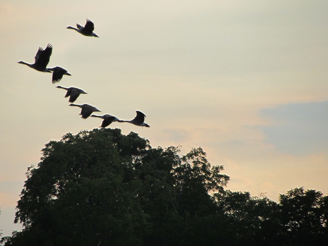
The campground had been decorated for Harvest.  We were seeing more and more such decorations; lots of corn stalks and pumpkins in mass displays with autumn toned chrysanthemums which are out and flowering in great swathes of colour. We took some photos.


Tuesday 25 September 2012

Heading in to Fall.

We woke to rain the next morning. I guess that Fall is only about 5 days away but - rain!!
What better to do than to drive.  Even better is to go shopping!!  We did both. We set off quite early - 7.30am, before there was much traffic on the road, not even a school bus. The law is that when a school bus has its red lights flashing, all traffic must stop and wait until the lights stop flashing - in both directions.

The countryside looks quite different when it is raining.  Everything is closed up and forlorn looking. Roadside workers are well rugged up against the weather though they still give us a wave as we pass.
We drive into Westcott Beach State Park but it is closed for the season.  We can't see much anyway except that the trees are definitely changing colour.

We stop at Watertown and spend 2 hours stocking up on food and adding to our bedding supplies as Trevor's sister Coralie is coming to spend some time with us at the end of the month. An umbrella also seemed a good idea.


From Watertown (well named) we headed back up to Lake Ontario taking Highway 37 along the shore where Lake Ontario meets the St Lawrence river. The entrance to that part of the seaway is dotted with numerous little islands ... about 1860 to be fairly exact. The area is called the Thousand Islands Region. We are going to see Boldt Castle on Heart Island at Alexandria Bay. It looks wonderful in the brochures!
But the skies opened up just as we were navigating the narrow streets into Alexandria Bay; there was no where to park the RV and it all seemed a bit too difficult. The rain and fog also limited visibility and I don't think we would have seen a lot on the ferry ride. We decided to continue on.

Of course the rain lightened off not long after, but by that time we were further along the St Lawrence river. The countryside looked quite lovely after the rain. A large freighter was on its way up the St Lawrence river. A pretty spot to stop for lunch.
We planned to cover another approximately 100 miles to either Westville Center or Chateaugay close to the border of New York State with Vermont.

Then we drove through Akwesasne and a Casino!
We drove into the large parking area thinking to just have a look around noticing that there were a number of RV's parked - and hooked up!
 Amish transport.


So we stayed at the casino at Akwesasne! And it was free! Apparently parking at a casino is similar to parking at a Walmart store - free parking, although in the case of the casino, we had power, water and a dump and we were given a total of $25.00 in credits to play with at the casino. We had dinner at the buffet which cost $16.95 each and a glass of wine at $3.50 each. We then played the pokies and won a total of $39.00!  So a fairly inexpensive night out and free accommodation!!!

The Mohawk Nation at Akwesasne straddles the intersection of the international (US and Canada) and provincial (Ontario and Quebec) borders on both banks of the St Lawrence River.  Founded in the mid 18 century it was one of the Seven Nations of Canada.  Today it has 12,000 residents and, looking at the housing and businesses in the area it appears to be struggling. But the casino is thriving! A hotel is being built next to the Casino due to open next Spring.

We left the Casino at 8.30 the next morning.  It was a cold morning. My phone says 3 degrees C minimum and 9 by the time we were heading out.

We decided to have breakfast 'up the track'. Probably a bit misguided in this part of the state!  We stopped at Malone mid morning; a small town with narrow hilly streets.  Just what Trevor needs when searching for an espresso coffee! I made a discovery that Dunkin' Donuts serves espresso - OK when desperate. Trevor dropped me at the corner and I walked up to the store.  He disappeared down the road to drive around the block.  I think it was a fairly stressful 5-10 minutes for him while  I was having a chat with the girls in Dunkin' Donuts. The breakfast that I brought back to the RV was not what he needed on top of a stress caused agitated tummy!


We are now driving NE to Vermont.  The sun is out and it is a beautiful morning.  The trees here are turning the most vivid colours. There are a lot of road works happening and we have a few stops while we wait for vehicles coming the other way on one way lanes.
We are crossing above the Adirondack Mountains.  Montreal is 43 miles to the north and we are 3 miles from the Quebec border. The communities we drive through are called villages. Mumford & Sons on the radio station we are listening to!


Monday 24 September 2012

Map

Hi Everyone
Jeni & Trevor's daughter gate-crashing the blog here!!
I have updated the 'Where We Have Been' tab (above) with a new map.  The google maps link that I was using kept crashing so I am now doing it a bit differently.  Please let me know your thoughts on being able to see (kind of) where they have been!!  It is the pink wiggly line that you are following.  You can click on the image and it will enlarge to make it easier to see.
Kim

Friday 21 September 2012

Reflections on Niagara Falls.

The Niagara Falls has always seemed (to me) out of reach as a destination.
Our previous travels have evolved from the dictates of limited time and the need to see as many places as we could in that time. We have never been able to travel to US in the fall as that is not a holiday time at home - and - there were weekly wool sales! With the freedom that this year is giving us, in our travels to Niagara Falls we have acheived a (possibly unrealised) dream.
It was awesome! Each morning as we approached the Falls a sense of excitement grew until the first sight of that incredible body of water. And we were not alone!! Whenever we were there so were a lot of other people all happy to spend time just gazing at the Falls.

One last photo!!!

We did have a moment .... Trevor downloaded the photos I had taken of the Falls, deleted them from the camera and then could not find them on the laptop! Thank goodness for the Recycle Bin!

On Monday 17 September we left Scott's Tent & Trailer Park heading back to the US.
We had met Doug and Brenda from Ontario, our neighbours in the Park and like lots of people we have met in the RV parks had started chatting with them. We all have a common interest - RV's of course, but also an enthusiasm to see as much of this beautiful country we are travelling in. Lots of  people also express a wish to come to Australia at some time in their lives. And we agree with them that they should come see us!!
Hope that they do not all arrive at the same time!

And you know - there is always a downside! Trevor got a wasp sting while cleaning the front window of the RV.  I think it hurt a bit??
We arrived at the US border at 9.55am and were through by 10.15am.  Must be getting better at it. We didn't mention the South Dakota drivers licence as the last time we crossed back into the US that really seemed to throw a spanner in the works. "How come you have a 12 month visa and a South Dakota licence and you are only visiting???"
We did lose the tomatoes and capsicum (quarantine) but I still have my little cactus pot plant.  The officer was cordial.  He suggested we travel through New York State along Highway 18, the scenic route along the shores of Lake Ontario and the St Lawrence River which is just what we did. We have now touched all of the Great Lakes.

The highway took us through beautiful places; the scenery was spectacular. A lovely sunny day as well.
The road surface left a bit to be desired - there was a spot of about 20 miles which was particularly difficult. We seemed to be on an older, almost forgotten highway.  The overhead bridges were also fairly  low!  I watched with concern as the heights came down - I even ducked a couple of times. We believe we need 13ft six inches clearance - they were getting lower than that.  Trevor had to pick the spot to drive underneath and we held our breath. We were able to exit that highway just as an overhead bridge showing 10ft 5inches was approaching! I knew
mid morning coffee was not on the agenda.

We exited Highway 18 at Rochester and onto Highway 104. At Webster we refuelled.  I made lunch.
We drove on to Pulaski right on the lake. Camped at Rainbow Shores Park.  A large park with RV's, cabins and other permanent accommodation but now very quiet. Trevor thought he would have a swim so we walked to the water.  The shore was not very inviting unfortunately. Very large stones which were hard to walk on! A quick change of mind! Laundry was a poor option but necessary.

The shores of Lake Ontario


Thursday 20 September 2012

Thursday 20 September 2012

We are in Bangor, Maine. (Eoin Cameron has a lot to answer for!)
We left Michigan last Thursday after visiting the Henry Ford Museum - see earlier post.
Our travels since then have taken us back into Canada; crossing back into New York State; Vermont, New Hampshire and today into Maine.
It has been quite a week ...

Driving through Detroit was a test! Where to cross the border into Canada - the bridge or the tunnel? A no brainer really but the gps was intent on taking us through the tunnel. As we got closer, a three way conversation ensued between Trevor, the gps and me! Now it can get a bit hairy at these times but we were as one against the gps:  'We want to take the bridge!!'  Finally we had to turn 'her' off.
Then - which lane should we take - the one for cars or the one for trucks? No RV's in either to give us a clue. We opted for the truck lane as it looked bigger.  Wrong!  But the border police were kind to us  "out of towners ..." as they called us.  It sometimes helps to have a map of Australia on the back of the RV and South Dakota number plates!!

Ambassador Bridge

Then we are back in Ontario,Canada.

Who says we are not a truck!
Almost immediately we are into rural countryside deciding to travel on a provincial highway along the shores of Lake Erie: large wind farms, farming properties, crops and glimpses of the lake. We passed through a number of small communities after turning off Highway 401 to State Hwy 3.


We stopped at the Grand Oaks RV Park in Cayuga, 2 kms (yes we
are in Canada) off Hwy 3 and overlooking the Grand River.
It was  rustic with  lots of trees and very quiet.  Even the group of army cadets on a 4 day exercise could not break the tranquillity.  We also felt very safe!!


The next morning we were headed for Niagara Falls!! We restocked our supplies. Canadian food prices are higher than in the States and we were also mindful of quarantine restrictions when crossing back to the States.
We missed Highway 405 as we drove through Fort Erie and found ourselves on the Niagara Parkway which was a very pretty drive along the Niagara River. We then found Lundy's Lane where several RV Parks are situated and opted for Scott's Tent & Trailer Park - a great spot.  We booked for 3 nights.

Even though it was raining and late afternoon by that time, we stood in the rain for half an hour to catch the Wego bus to the Falls.  How could you not go see such an awe-inspiring spectacle.
Louis Hennepin, a French priest and one of the first Europeans to gaze upon Niagara Falls in 1678, wrote that "the Universe does not afford its parallel."

He was right! And 10 million tourists a year also know a thing or to! I felt quite emotional on catching my first sight of the Falls! It is hard to describe the beauty and power of all that water tumbling over rocks.

The Niagara Falls straddle the international border between Ontario,Canada and New York State, US and
 include the Horseshoe Falls - on the Canadian side, and the American Falls and  Bridal Veil Falls both on the US side. We visited from the Canadian side as we had been told that was the more spectacular view.
The combined falls form the highest flow rate of any waterfall in the world with a vertical drop of more than 165 feet. Horseshoe Falls is the most powerful waterfall in North America.


 We signed up for an Adventure Pass and over the next two days experienced the Falls from a number of different perspectives including in tunnels behind the Horseshoe Falls, walking a boardwalk beside the Niagara Rapids, witnessing the creation of the Falls and taking a boat cruise which goes right up to the base of the American Falls and then to the basin of the Horseshoes Falls.  We also walked across the Rainbow Bridge, and the US Border  to experience the Falls from the American side.  Not to mention viewing the Falls illuminated at night and walking and more walking!!! But it was all worth it. What a place!