Trevor swims - there is a great pool at Furnace Creek.
 The Visitors Centre is very comprehensive: a park orientation film -'Seeing Death Valley' - narrated by Donald Sutherland and several video presentations. Displays about the park's geology, climate, wildlife and natural history are all extremely interesting. Park entrance fees are collected here. We are getting value out of our National Parks card, which we purchased in Virginia for $80.00.

It is another hot day - the temperature goes well above 100F.
 |
| A coyote close to the RV park |
Later in the day it becomes very windy. The airconditioner is a must!
The forecast is for even stronger winds tomorrow!

But that's OK. We are loving just being here.
 We explore the Borax Museum and the history of the Harmony Borax Works, a mining operation more than 120 years ago. After prospectors found borax in 1881, the Harmony plant was built and began to process ore. At capacity it employed 40 men producing 3 tons of borax daily.
The early miners used the famed 20-mule teams to haul borax 165 miles out of Death Valley to the railroad town of Mojave. The teams averaged 2 miles an hour and it took them about 30 days to complete a round trip!!
The teams included 18 mules and 2 horses attached to large wagons; amongst the largest ever pulled by draft animals. With the mules, the caravan stretched over 180 feet!!
When one considers the nature of the desert landscape, the extremes in climate and the harshness of the wilderness, it is almost beyond comprehension that such activities were even contemplated let alone sustained at various levels over decades.
 On 6 May we leave Furnace Creek, complete our drive through Death Valley and cross the state line from California into Nevada. We have been in California for 2 months; southern California. We will return to northern California in several months time.


We have a light breeze for our drive out of Death Valley - thank goodness! We leave at 7.45am -first going north, then north east as we near the boundary of Death Valley and approach Nevada.
 |
| Scotty's Castle. |
 We pass Scotty's Castle, named for Walter Scott, a charlatan and some-time performer in Buffalo Bill's Wild West Show.
Another strange tale which stretches the imagination and adds to the mystique that is Death Valley.
 At 9.30am we cross into Nevada. We are gaining in elevation; the temperature has dropped to about 56F; shrubby vegetation covers the hillsides making them look green. There are no other vehicles on the road.
We intend to stop at Tonopah, Nevada - 140 miles from Furnace Creek in Death Valley, but when we get there we decide to continue driving. Tonopah is a rough, dusty, country town - no Starbucks or espresso to be found. And it is cold - 51F.
We are approximately halfway between Las Vegas and Reno - 2 extremes; on the one hand the glitter and sophistication of largely populated cities and on the other hand a vast and mostly empty stretch of desert. Tonopah is the latter. We drive on.

We cross a series of plateaus and peaks. It is very windy and the RV is getting buffeted about. We can see rain falling out to the north. We climb to Saulsbury Summit - 6,522ft.
At noon it is 62F. The wind is blowing tumbleweeds across the road. Now it is raining and bleak. Are we the only people left in the world???


Then we are on Hwy 375 - the Extraterrestrial Highway - 98 miles long. It is so named because of the huge amount of UFO sightings along this stretch of concrete and because it intersects Hwy 93 near top-secret Area 51, part of the Nellis Air Force Base - a supposed holding area for captured UFO's!!!
We keep our eyes open - we might see a UFO?? Possibly a cow!
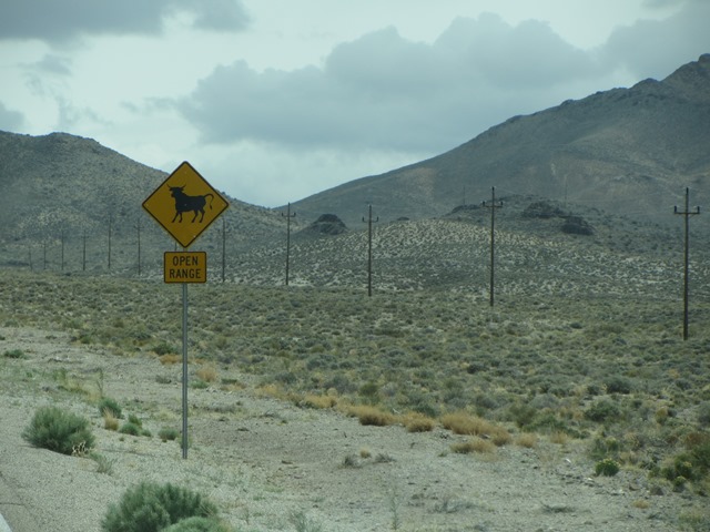
 We are crossing mostly unoccupied desert. We see few vehicles. Cattle roam as it is open range with no fences.We drive the length of a vast plain bordered by mountains which must be at least 40 miles across. Then more passes and plains. The road less travelled for sure. Does anyone know where we are??
About 1.15pm we pull into a tiny town called Rachel - Alien City! Little A'le'Inn sells extraterrestrial souvenirs and UFO artifacts. We settle for a piece of homemade rhubarb pie!
 |
| At Rachel |

Then we are back on the road; more mountains, passes and plains.
At 2.30 we turn onto Hwy 93 to Caliente.
Willie Nelson is playing on the ipod - 'Across the Borderline' - suits this landscape.

 The last 12 miles into Caliente are windy as we descend out of the mountains. We arrive at Youngs RV Park about 3.15pm - a big day - from Death Valley in California and almost across Nevada.
 Caliente is a small, old railroad town, a fact that we become acutely aware of during the night as the trains are frequent!
We are at an elevation of 4,300ft and surrounded by mountains.
It is a pretty place.


The next morning we continue on to Cedar City, Utah. It has rained overnight; everything looks and smells lovely and fresh.
We will climb more today. Cedar City is at an elevation of 5,800ft.
 We are heading straight into black clouds and threatening skies. The sun, which was out when we left Caliente has now gone and we are driving under really low clouds. The temperature is also dropping - now 44F, then 40F, then 38F.
We are climbing into hilly, even mountainous countryside covered in clouds. It then starts to rain. No! That's not rain ... it's snow!! We can see the white flakes landing on the windscreen.
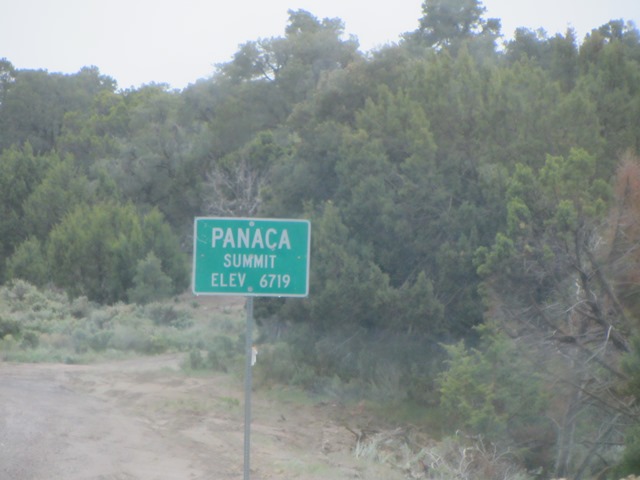
We climb over Panaca Summit Pass at 6,719ft.
The snow/rain doesn't last long; the skies look to be clearing ahead.
 At 9.15 we cross the state line into Utah. We are now on Mountain Time and go ahead 1 hour.
 At 11.30 we drive into Cedar City. The sun is shining; it is a little warmer. We check out the RV parks in town - there are three. Cedar City has a population of 29,000. It is a small town.
First - a coffee! Yep they have a Starbucks.
 |
| Driving down Main Street, Cedar City. |
Almost immediately we notice the effects of the altitude - we are now at 5,800ft. Breathing is difficult; we take frequent large gasps of breath and notice we are yawning a lot; feel tired too. Hope that all wears off quickly.


