 From Benson we take I-10 to Casa Grande; a busy interstate with lots of trucks, traffic and road works.
The arid scrubby countryside is scoured by dry washes.
We find a country music station on the radio - Willie and co; just right for the kind of country we are driving through!
As we approach Casa Grande we pass pecan farms on each side of the road.
Then we begin to see lots of large cactus trees. We will find out a lot more about them over the next few days. They are saguaros, pronounced 'sah-wah-ro'. They look rather human-like with lots of arms.


Already we are noticing the warmer weather and dry air - it feels good.
Winter in Casa Grande.
 |
| A magnificent Saguaro - the best we have seen! |
Casa Grande is approximately halfway between Phoenix to the north and Tuscon to the south. It sits at the intersection of 2 major interstates, I-10 and I -8 and has a population of approximately 50,000 full time residents. The population increases by about 50% with part time residents in the winter months.
Once we are settled into the RV park, we go out for a meal with Bob and Carol. It's Friday night. We have a short wait for a table but no one is in a hurry.
+16.2.13+003.JPG)
The next morning we head out early. We are going to drive the Apache Trail between Apache Junction and the Theodore Roosevelt Lake. The Apache Trail was a stage coach trail that ran through the Superstition Mountains, so named after the Apache Indians who originally used this trail.
We head north from Casa Grande. It doesn't take long to leave the city behind.
+16.2.13+007.JPG) |
| A 'pit' stop |
+16.2.13+004.JPG)
+16.2.13+006.JPG)
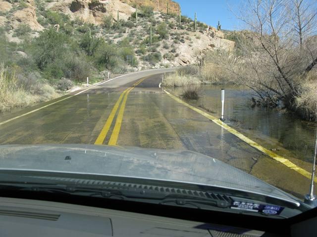
Much of the Apache Trail is paved and winds steeply through 40 miles of rugged desert mountains, passing by reservoir lakes - Canyon Lake and Apache Lake. The narrow winding road is unpaved from just east of the town of Tortilla Flat to Roosevelt Dam. It is not for the faint hearted!
+16.2.13+018.JPG) The road atops steep cliff drops with many hairpin bends and switchbacks; there is little in the way of safety barriers and caution is required.
The road atops steep cliff drops with many hairpin bends and switchbacks; there is little in the way of safety barriers and caution is required.Bob is a great driver. Mind you, as with everywhere, there is the odd 'mad' driver, even on such a road!
We also pass a motor home coming the other way!!
+16.2.13+020.JPG)
+16.2.13+024.JPG)
+16.2.13+028.JPG)
+16.2.13+027.JPG)
+16.2.13+031.JPG) |
Tortilla Flat is a tiny town on the Apache Trail.
It marks the end of the paved road. It is quite a tourist stop; a real town with a post office and a population of 6! And an ice cream shop.
I can recommend the prickly pear flavour!!


+16.2.13+023.JPG)
It was an amazing drive. Every turn of the road - and there were many - brought incredible views of canyons, desert plants and trees and desert, lake and mountain vistas. Here are just a few of the photos we took that day.


+16.2.13+043.JPG)
+16.2.13+061.JPG) |
| Our intrepid driver! |


+16.2.13+064.JPG)

+16.2.13+070.JPG) And then we reached Roosevelt Lake, a large reservoir formed by the Theodore Roosevelt Dam, on the Salt River. It is the largest lake or reservoir located entirely within the State of Arizona.
And then we reached Roosevelt Lake, a large reservoir formed by the Theodore Roosevelt Dam, on the Salt River. It is the largest lake or reservoir located entirely within the State of Arizona.+16.2.13+074.JPG)
It is quite a beautiful sight!
+16.2.13+075.JPG)

The cliffs were so high and the climbers appeared as dots on the rock face.
+16.2.13+079.JPG)
The sun was setting as we returned to Casa Grande.
A wonderful day - thank you Bob and Carol
No comments:
Post a Comment