 It is approximately 700 miles to San Francisco where we will leave the US on 20 October. We put in a big day and cover about 310 miles stopping just a few miles from the California state line.
The weather has stayed fine although cooler; we have a great day for driving. At first we are on narrow, country roads, then driving through ranch country and finally onto I-5.


We arrive at Cypress Grove RV Park at 6.00pm ... omelettes will have to suffice!
 Although we knew that the RV Park would be close to the Interstate we didn't realise that it would be close to 2 major highways!! In fact I think we are between them! I guess we are tired enough and it doesn't bother us.
We are off again early the next morning, and it is a cold ... 40F, only 4C.
It is Saturday; we don't have to hurry so we attend to a couple of things on the way. Like checking the tyres. We find a Pilot Truck stop as we have to use the truck side where the air is located. We are surrounded by lines of trucks; we try to look the part but there is always a problem with the air hose not reaching, or not working until some sort of lever is moved. I hover waiting for instructions. I know Trevor is happy when that exercise is done. We get gas for $3.45 a gal. The lowest we have had it for some time. It will be higher in California.
Then we call into a shopping centre for a Starbucks. While I am getting the coffee someone stops by the RV to enquire about the price. That guy is serious; we have his contact details if there are any problems with our prospective buyer. (refer last post)


We climb to a summit of over 4,000 feet as the highway winds its way through the Cascade Ranges. The views are breathtaking and with less traffic on the road we can both enjoy the ride.
We cross the state line into California about 11.30 am


There in front of us is Mt Shasta at 14,179 ft. Located at the southern end of the Cascade Range, it is the second highest peak in the Cascades and the fifth highest in California. It dominates the northern Californian landscape. It is a beautiful looking mountain and we get very clear views of it.
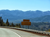
 We stop at Yreka, a small town just off I-5. Trevor then decides that we will continue south on State Highway 3. I am not so sure ... road signs suggest that it is not for the faint hearted, motor home or not; that it is windy, with elevations. It is noted on the map as a scenic route but not for trailers or big rigs.
We have about 100 miles of Hwy 3 before it connects with Hwy 299 east to Redding.
We do have all the time in the world so off we set.
It is a beautiful drive I have to admit, but it is everything the road signs state. Windy, tight bends, narrow roads, steep with drop offs as we climb without any rails or sides to the road.
We feel very 'big' on some of the corners and I can see how impossible it would be for a 5th wheel or bigger rig.
The drive takes nearly 4 hours which tells you that we had to take it slowly.
 I have few photos of the most difficult terrain as I was clutching the side of my seat and not looking out of the window. It was a relief to find a straight road after the worst of it.
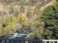
 The scenery is breathtaking especially as a lot of the trees now have their fall
colours.


 The photo above shows the country we are driving in, in the motor home.
From Yreka we pass through Fort Jones, Etna and Callahan. We reach 5,205 ft and cross the Scott Mountains and the Pacific Crest Trail. The highway then runs along the Trinity River and through the Whiskeytown-Shasta-Trinity National Recreation Area and Trinity Dam on Lake Lewiston.
As we approach Redding we get another view of Mt Shasta.

Quite a day!!


Wow --those photos are amazing ---My computer at last back in business--sorry to have missed so much of your wonderful trip ---lots of love ---normie xx
ReplyDelete