 We take a drive on I-70 to Rifle, Colorado. We remember Rifle, or think we do, from our drive from San Diego to South Dakota in 1986. When we drive Main Street in Rifle we are not so sure. We both recall a long Main Street with verandahs over wide sidewalks; well that's not quite what we find.
 What we do find is a great cafe for breakfast! Creekbend Bistro - we each have the New York pancakes filled with berries, 2 poached eggs and bacon. Wow!! They even have espresso!
 After breakfast we drive around Rifle; look into the Visitors Centre and go watch some Canadian geese looking after their families.
 We take the road to Rifle Falls, a winding gravel road lined with snow drifts. We find a State Park entrance and pay $5.00 entrance fee into an honesty box. We are in the wrong State Park and never do find the Falls - we are in the Rifle Mountain Park. Lots of rock climbers and their supporters along the road.
Back in Grand Junction we park and walk to downtown. It is pretty with lots of cafes and restaurants. There is a festival in the centre of town. We wander over to where all the action appears to be happening; it is a Gay and Lesbian event. When Trevor finally twigs, we are out of there!!

Our stay in Grand Junction comes to an end. Our next destination is Denver - eventually. Whichever highway we take to Denver - I-70 or Hwy 50 - will climb to high mountain passes. We have been told there is a mountain train ride out of Manitou Springs that we shouldn't miss. So we opt to take Hwy 50 - south and then south east to Gunnison then north east to Colorado Springs. We still have about 2 weeks before we fly to New York so we have plenty of time to really explore Southern Colorado.
 |
| Where we have been ... |
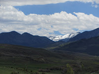
 We have a sunny day with wind. The forecast is for very windy conditions today and tomorrow. Almost immediately we leave the RV park we see snow on the mountains directly south of us; I think we will turn south east before we reach them but as we are headed for the Rockies I guess we will get into cooler weather as we climb to higher elevations.
The front windscreen is sparkling!! Trevor spent about 4 hours on the windows and bodywork yesterday - we look good!!
Just before we reach Montrose we climb the Cerro Summit - 7,958 ft. We drive into Montrose about 10 o'clock and stop for coffee!!
 The highway is expected to re-open by 3.00pm. There is a small town on the map at mmp 117 - Cimarron. We will head there.
The road is very quiet. I guess most people haven't the time to sit and wait as we do. What if we get stuck in Cimarron??
Certainly Cimarron is much smaller than we thought. Its population can't be more than 3 and a dog! We make lunch and sit by a stream under some big old trees. It is so peaceful without highway traffic.
 Finally a trickle of traffic starts to pass by. We set off again. The road is open one way. When we reach the spot near where the roll-over happened we are escorted through in a single, narrow lane of traffic. The roll-over caught fire to the bush on both sides of the highway. Incredibly the driver wasn't hurt.
 |
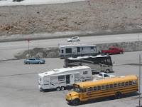
| Where is all the traffic? |
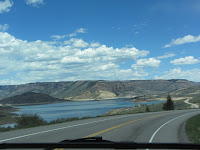
 Highway 50 takes us along the banks of the Blue Mesa Reservoir. At an
elevation of 7,519 ft it is the largest body of water entirely in Colorado.
Created by the Blue Mesa Dam the reservoir is 20 miles long, has 96 miles of shoreline and is the largest lake trout and Kokanee salmon fishery in the US.
Hwy 50 crosses the lake at Middle Bridge.
This coming weekend is a long weekend; it is Memorial Day on Monday. Although now only Wednesday a number of campers and RV's are coming into the area which is popular for boating, fishing, wind surfing and water skiing - and ice fishing in the winter.

 We seem to have driven out of the wind. It is a beautiful afternoon.
We reach Gunnison about 3pm and book into the KOA.
 |
| A visit from Jenny, the donkey! |
 Gunnison is a pretty town. It is the hub for all kinds of outdoor activities; numerous businesses with off road vehicles, bikes and canoes for hire as well as tour operators for white water rafting. Walmart's largest display is of fishing rods, particularly fly fishing rods and tackle.
 We drive out of Gunnison through farming country. Lots of cattle; stock yards on most properties. Little streams run through the pasture. We can see mountains with snow in the distance.
Today we will climb a pass in the Rockies - Monarch Pass at 11,312 ft!
And we will cross the Continental Divide.

By 11.15 we are climbing in earnest. We have 7 miles straight up and I just know that the dropoffs will be on my side!! The temperature is about 65F.

I was right! Steep drops away from the edge of the road are all on my side. Many places have no guard rails! I keep busy taking photos.
We reach Monarch Pass at 11.40. It is now 38F and very cold. We stop at the summit.


 The lady in the gift shop suggests we take the chair lift to the top of the mountain!!
It is only $7 each. What a wonderful view from the top - 12,200ft. We are at the southern end of the Rocky Mountains. We can see many peaks including Pikes Peak where we will take the train ride in a few days.

 |
| In the carpark!! |


The free popcorn after our chairlift ride tastes wonderful as we make our descent down from the Pass. It tastes all the better for knowing the climb up is over!!


No comments:
Post a Comment