Thursday 21 February 2013

Silver City

We decide to stay in Silver City over the weekend and rent a car. We pick up the rental car at noon. It is a cold and grey day. I don't think I have had my parka off since we arrived in town!

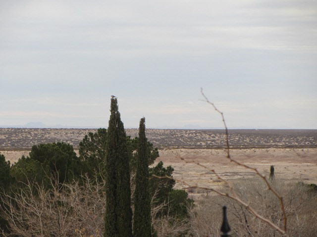
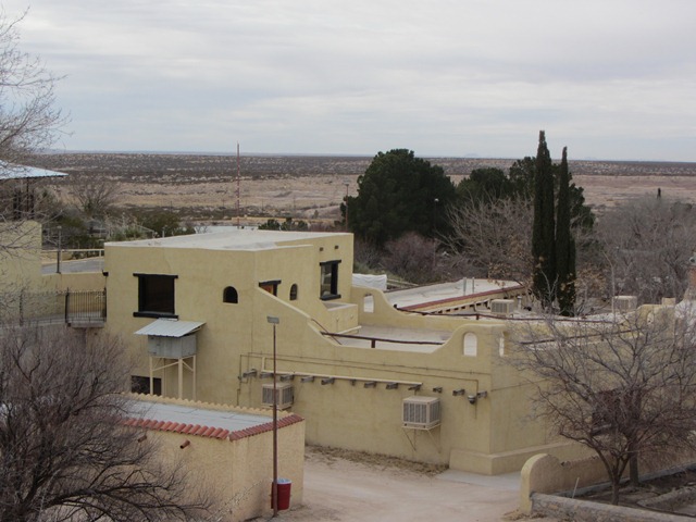
Silver City is in the foothills of the Pinos Altos Range, south west New Mexico on the Continental Divide. It has a population of 10,500, is at an elevation of 6000 ft and is known for (amongst many other things) 'having 360 days of sunshine ...'   Well we are in for a couple of days without sunshine!

In 1870 a group of prospectors discovered silver in the hills above what would become Silver City. In 10 short months the newly christened Silver City grew from a single cabin to over 80 buildings. In the early years of development all of south western New Mexico was harassed by Apache raids. The nearest railroad terminal was in Colorado. Despite all odds Silver City flourished; its mills were producing $16,000 of bullion a week by 1875 and it soon became the supply centre for the booming industry. More homes were built, a volunteer fire department was formed, the telegraph line and then the Southern Pacific Railroad reached the town, telephone lines were installed and an electric light plant was completed in 1884.

But it was a shortlived boom. In 1893 the bottom dropped out of the silver market.  Mines were closed. Silver City took a different path - cattle farming, new mineral discoveries and the development of the area as a TB convalescence haven helped stabilize the town and surrounding area.

 Prior to the discovery of silver was the discovery of gold. In 1859 a group of Forty-Niners drifting home from the California gold rush discovered gold in the Pinos Altos (Tall Pines) area just north of Silver City. Pinos Altos became a rough and tumble town of gold bonanzas and Apache raids.

Even earlier than those discoveries was that of copper. The oldest active mine in the southwest, the Santa Rita del Cobre (which became the Chino Mine) was worked as early as 1800, first by Apaches, then Spaniards, Mexicans and then in 1909 as an open pit copper mine by Americans. That too had a chequered history: the Apaches were so active in the area that the mine was surrendered up to them in the mid 19th century and it was only after the surrender of Geronimo, which marked the end of the Indian Wars, that the mine returned to use.

But man's presence in this area has been a long one. The pre-historic Mimbres Indians of the Mogollan culture inhabited the mountain wilderness from as early as 400AD!
We try to get up to the Gila Cliff Dwellings on our second morning in town but are beaten by the weather!
It was snowing as we left the RV Park. It had been 36 F, then dropped to 28 F.

It is a 2 hour drive into the mountains and we make it to mile 14. The road is getting covered in snow; visibility is poor. I suggest we turn around.

So we go back to town. Find a coffee and a dog to talk to!


Pinos Altos


We then drive south to the City Of Rocks; amazing rock structures 32 miles south on Highway 180;  a striking result of the geological process of erosion over time. And it looks like a city with streets and buildings. The temperature remains in the low 30's as we continue our drive into the Mimbre valley.  It all looks terribly dry; there is a river somewhere but we seem to be constantly seeing dry beds. And then a road sign - winery!!! Could it be possible?
We turn off to the winery. Sure enough! We have some tastings; quite a range including several reds. The best part of our visit is listening to the owner's history of the winery and her family's involvement in the area. She and her husband own and run the winery. The vines are watered by individual drip reticulation from underground springs. It was great!

Path to Visitors Centre at City Of Rocks

Then back on the road to Silver City.  We drive by the Chino Open Pit Mine, the oldest active mine in the Southwest.


Did I mention that Billy the Kid lived for several years in Silver City when he was a boy??


Wednesday 20 February 2013

New Mexico


A long line of trucks.
On 5 February we cross the state line into New Mexico.
On the way out of town we give the motor home a wash at the Blue Beacon Truck Wash. We arrive at the truck wash at 10.20am. There is a long line of trucks; this could take a while. In fact we were out by 11.25; we had the wheels blacked as well!


We have a $20 voucher from Blue Beacon (which is  a nation wide company). After our previous, and first wash back in Tennessee, Trevor complained by letter to head office. They didn't do a very good job and he wasn't happy. We received a letter of apology and the voucher.
It made this wash only $26.00!! And we look pretty swish driving out of El Paso.


Just before crossing into New Mexico we refuel and check tyres.
Quite a process. We have to go through the truck stop for air, then back to the gas station for fuel as we take gas (petrol) not diesel.


The scenery is spectacular; first mountainous then onto plains which go forever - or so it seems.
The traffic is easy but the trucks just keep coming!

Our first stop is Las Cruces about 40 miles from the state line. We go to a Wells Fargo bank to validate new Visa cards.

Welcome Centre - New Mexico
We had both received text messages purporting to be from Wells Fargo, wanting account information over the phone. I checked with the San Francisco branch where we opened our accounts; they advised us to cancel our current accounts and open new ones! We maintain a high level of suspicion of unfamiliar emails or text messages!


Courthouse - Las Cruces


A check point on the Interstate

Little Vineyard RV Park, Deming


We stop at the Little Vineyard RV Park in Deming, New Mexico and stay on another day.
Trevor has a sore throat and cough which is annoying him.
A lazy day; crockpot dinner.  Great showers and restrooms!


From Deming we drive north on Highway 180 to Silver City. Another cold night;  35F (about 1C)  but nice and sunny when we set off and 59F (14C). No wind which is good as we are getting up in elevation ... now 5,900 feet.
We book in to the Rose Valley RV Ranch just out of town.  It is a great place, full of farming relics - tractors, ploughs, old farm machinery.
We stay 4 nights.


'Out in the West Texas town of El Paso ...'

We find El Paso to be different to our expectations in just about every way!

It stands on the Rio Grande across the border from Ciudad Juarez, Mexico. The 2 cities form a combined international metropolitan area, with a population of 2 million; the city of El Paso has a population of approx 700,000. It is a mix of Mexico, Texas and America in a fascinating sort of way.

However the idea of  'combined' cities is negated by the presence of an 18 foot high border fence; a thin trickle of the Rio Grande river which flows through concrete channels between the 2 cities, and border patrol vehicles stationed approximately 200 feet apart in the metropolitan areas and further patrols along the length of the border. We had hoped to cross into Mexico here but were warned not to do so. These warnings came from several different sources and we take them seriously. The warnings relate to violent crime and personal safety!


I walk each morning;  I can see Mexico on the hillside. I am in a fairly run down area of the city but there are a number of other walkers - (my age perhaps) - we nod as we pass each other.
The mornings are very cold. I have  4 layers on, a beanie and gloves!

Yes!!!! 
The homes in the neighbourhood I walk appear very basic and small. The gardens are almost non existent, the yards are dusty sandy areas with rough paths and few trees ( bare at this time of year). The sand looks to be raked? Lots of dogs behind  fences. I manage to set most of them off.
The houses are a desert colour, pretty much all the same.
We are about 4000 feet and I notice the elevation when walking.


With our rental car we are able to explore a lot of the city and surrounding areas. We visit Harts Mill which is right beside the Mexican border; one of the oldest buildings in El Paso. It dates to around 1850 and is said to be the location where Onate crossed the Rio Grande in 1598.


Don Juan de Onate y Salazar (1550-1626) was a Mexican explorer. In 1598 he headed an expedition to New Mexico, fording the Rio Grande at present day El Paso and claiming all of New Mexico.


We try to get a closer look at the border but are stopped by a Border patrol vehicle. They are stationed 200 feet apart along the border. It is a bit like an armed camp with helicopters hovering overhead and the massive border fence.

El Paso is much more than a city. The nation's biggest urban wilderness park, Franklin Mountains State Park, about 26,000 acres of Chihuahan desert with an accessible mountain, lies in the heart of the city.


We also visit the Chamizal National Memorial which celebrates the peaceful settlement of a dispute over the international boundary at El Paso, Texas and Ciudad Juarez, Mexico. On 29 August 1963, after decades of arguing about who owned a piece of land shaped and reshaped by the meandering Rio Grande river, the question was finally resolved by diplomacy.  The river was constrained within a concrete channel for four and a half miles, forming a permanent border between the two nations.

Although the museum at the memorial was not open the day we visited, when we said that we were visiting from Australia we were invited in and the museum was opened; a ranger gave us a lot of his time explaining much of the history of the memorial and his insights into present day life on the border.

Mexico - through the border fence.

Memorials at Harts Mill


The International Bridge border crossing.

Border Highway


The Equestrian, a magnificent bronze sculpture stands at the entrance to the El Paso International Airport. The rider depicts Don Juan de Onate. It stands 44 feet tall, weighs 17 ton and took 9 years to complete.


On Sunday afternoon we drive out of town to the Cattleman's Steakhouse at Indian Cliffs Ranch, a large family style restaurant on a 46 square mile working ranch. Although we don't feel like a meal we have a beer and a plate of beef tips. Wonderful!

Back to town to watch the Super Bowl. The  game takes 4 hours, including a blackout! Unfortunately the 49ers lost. Margaritas and tapas (really nibbles) for tea. A new diet perhaps??

The view from the restaurant


The Cattlemans Steakhouse and Ranch house


Almost too close and personal!


And then we found Rosa's Cantina! For those that don't know Marty Robbins' song this will not mean anything at all. But when we tell people that we found Rosa's Cantina in El Paso, the overwhelming response is 'You're kidding' !
Truly there it was, right beside the border .. and it continues to operate as a cafe.  Unfortunately it was closed on the day we were there.


The back door ?????

???????